NORSAR Software Suite 2017.3 is released

NORSAR Software Suite is a common framework for NORSAR software and consists currently of NORSAR-3D, SeisRoX and MDesign.
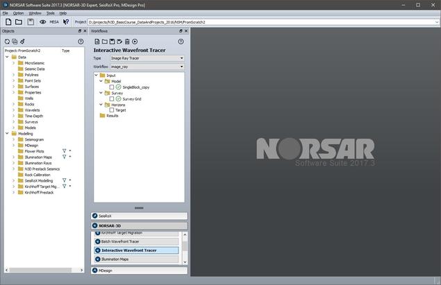
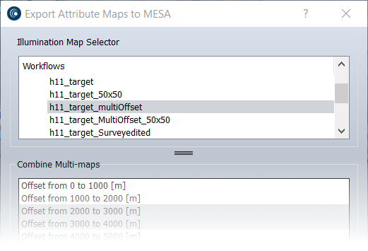
NORSAR Software Suite 2017.3 features a new MESA - NORSAR connector and a new Image Ray Tracer.
The MESA - NORSAR connector provides a direct, fast transfer of data between MESA and NORSAR.
- Surveys designed in MESA can be loaded into NORSAR Software Suite.
- Illumination maps computed in NORSAR Software Suite can be loaded into MESA.
The new workflow will help increase confidence that a survey design is properly-sized for a given prospect. In addition, the iterative nature of the new interface will aid the decision-making process by encouraging more testing and refining of design options. The interface is available in MESA version 15.1 and in NORSAR-3D 2017.3.
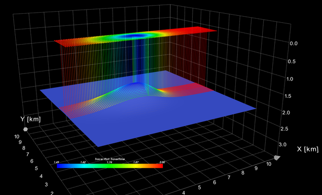
The Image Ray Tracer is based on the definition of the so-called Image Rays commonly described in seismic literature.
The Image Ray Tracer constructs time surfaces (time grids) corresponding to time migrated horizons from a given NORSAR-3D depth model. Image Rays are started from points in a user specified regular XY-grid at a given reference depth Z0 (usually Z0=0) in a direction vertically downward (i. e. started perpendicular to the reference plane). The rays are traced down through the model until a given model depth horizon is reached. The corresponding traveltime is multiplied by 2 (two-way) and mapped to the corresponding XY start point.