Seismic signals recorded from an explosion at the Kakhovka Dam in Ukraine June 6th, 2023

NORSAR has analysed seismic signals from regional stations in connection with the collapse of the dam in Ukraine on Tuesday 6. June 2023.
Data from regional seismic stations from Romania and Ukraine, show clear signals on Tuesday 6 June at 2:35 a.m. and 2:54 a.m. (local time in Ukraine). The time and location correspond to reports in the media about the collapse of the Kakhovka dam. The signals are consistent with an explosion and are not what would be expected for a dam collapse. We are unable to determine the type of device that was used to generate the explosion based on the seismic data.
We can determine the time of the explosions to within a margin of seconds. Both explosions are located with an uncertainty of approximately 20-30 kilometers around the dam. This uncertainty is due to the distance from the dam to the sensors (approximately 500-600 km), the distribution of sensors used for the location, measurement uncertainties, and unknowns related to the propagation of seismic waves in the Earth. A reliable magnitude is challenging to determine but we estimate a value of between 1 and 2 for the second explosion. We are unable to estimate an explosive yield based on our observations.
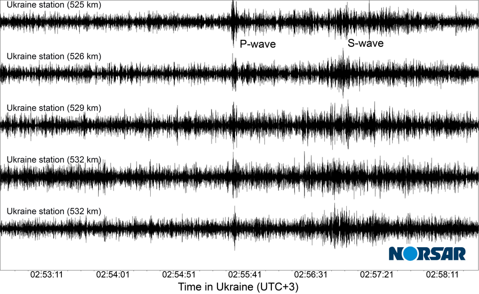
The figure below shows signals recorded at seismic sensors in Ukraine that are located approximately 530 km away from the dam.
Updated 22.06.23
